.
vessel BOLD MARINER IMO: 9136955, Bulk Carrier vesseltracker.com
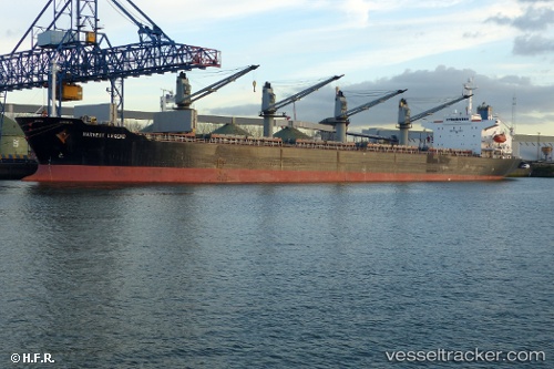
Vessel BOLD MARINER IMO: 9136955, MMSI: 370791000 Bulk Carrier

callsign: 3FRW7
size: x

Live AIS position: UTC. Near Chattogram), updated 2025-12-22 22:17:40 UTC.

Find the position of the vessel BOLD MARINER on the map. The latter are known coordinates and path.

marine traffic ship tracker show on live map

The current position of vessel BOLD MARINER is 22.44854 lat / 91.72496 lng. Updated: 2025-12-22 22:17:40 UTC

Currently sailing under the flag of Panama

BOLD MARINER built in 1996 year

Deadweight:
45674 t

Details:


Last coordinates of the vessel:
2025-12-22 22:17:40 UTC, 22.44854, 91.72496, course: -1, speed: 0

Track of the vessel in the last 28 days


Most frequent ports a vessels calls at BOLD MARINER (370791000):

Apapa, traffic: 16
Lagos, traffic: 10
Walvisbaai, traffic: 5
Bonny, traffic: 4
Port Harcourt, traffic: 2
Abidjan, traffic: 1
Luanda, traffic: 1

Link to the map:


Find another ship

BOLD_MARINER (370791000) last ports (portcalls and passsages)

Walvisbaai | 2024-01-08 16:39:02
Luanda | 2024-01-03 16:14:35
Lagos | 2023-12-27 22:03:54
Apapa | 2023-12-25 23:11:23
Lagos | 2023-12-23 21:31:15
Apapa | 2023-12-21 21:58:31
Lagos | 2023-12-19 20:46:20
Apapa | 2023-12-17 20:41:49
Apapa | 2023-12-13 20:12:16
Abidjan | 2023-12-08 13:24:16
Lagos | 2022-12-29 14:55:12
Apapa | 2022-12-29 11:53:24
Lagos | 2022-12-25 14:43:28
Apapa | 2022-12-25 11:12:48
Lagos | 2022-12-21 11:38:41
Apapa | 2022-12-21 08:56:31
Walvisbaai | 2022-12-12 11:40:28
Walvisbaai | 2022-01-18 22:55:10
Bonny | 2022-01-05 15:35:04
Port Harcourt | 2021-12-31 17:36:24
Bonny | 2021-12-26 10:55:02
Apapa | 2021-12-25 07:05:17
Apapa | 2021-12-25 07:05:00
Lagos | 2021-12-25 07:00:00
Lagos | 2021-12-19 08:40:07
Walvisbaai | 2021-12-08 09:17:22
Apapa | 2021-09-30 16:11:47